The Local newsletter is your free, daily guide to life in Colorado. For locals, by locals.
“In every walk with Nature ones receives far more than he seeks.” —Steep Trails by John Muir
May 7, 2016, a morning mingled with light mist and puffs of breath, wasn’t the first time we’d set foot on the Indian Creek trailhead. We’d driven down the same road outside of Sedalia the weekend before to scout the starting point for the 486-plus-mile journey to Durango. When we’d stepped out of my husband’s black Chevy Tahoe then, we sank to our shins in fresh spring snow. With the cold gripping our ankles and seeping into our running shoes, we surveyed the landscape and, seeing nothing but a blanket of white, retreated back to the SUV’s warmth. The following week produced several days of brilliant sunshine and warmer temperatures, and we returned to find the trail visible as it meandered along the edge of a creek and disappeared into a thatch of lodgepole pines. It was time.
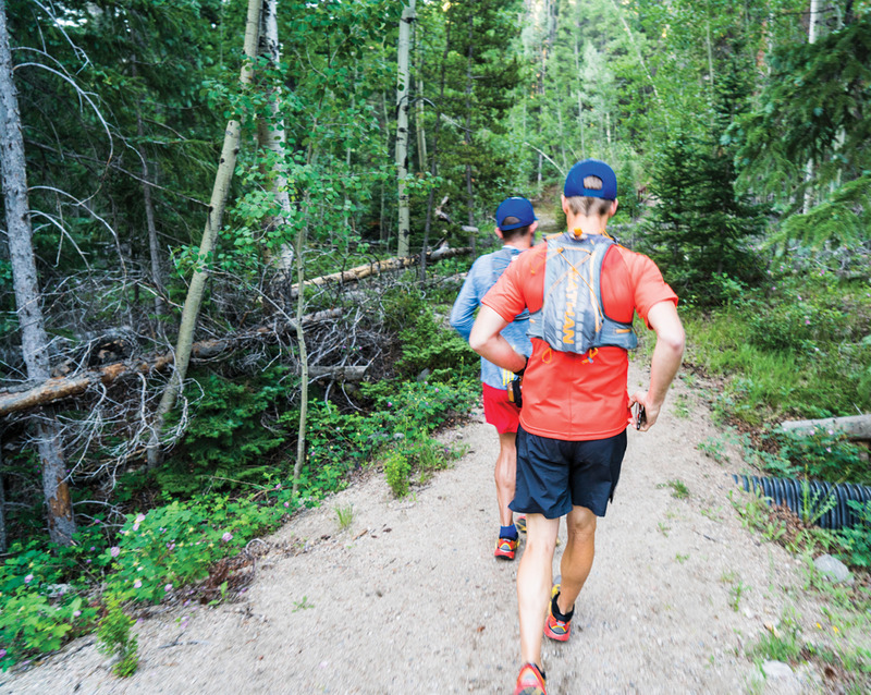
At 6:40 a.m., after five months of strategizing and nearly a year to the date of coming up with the idea, my husband, Heath Kirschner, started his watch as he and his running partner, Paul Landry, took their first steps onto the Colorado Trail. In the seconds before they were swallowed by the forest, Heath turned and offered a last high wave, his fingers pressed against the sky.
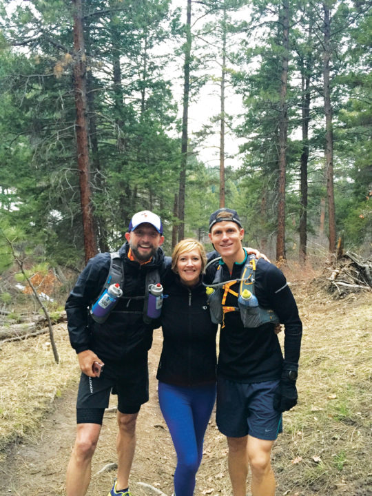
There’s a photograph of Heath, Paul, and me taken just moments before the guys began their journey. Standing on the tamped-down dirt against a background of pines so tall they extend beyond the frame, we’re smiling brightly, eyes wide with anticipation. What that photo doesn’t capture is our nerves, our excitement, and our disbelief that this day had finally arrived. What lay ahead were miles of mountains, rivers, aspen groves, and high-alpine meadows, which the two men would cross one footstep at a time. What lay ahead was weekend after weekend of schlepping our families (Paul’s wife, Lisa, and their two boys, Jack, nine, and Ben, seven, joined the trek) across Colorado, madly setting up camp and then tearing it down the next day. What lay ahead was a path Heath and I couldn’t have foreseen. We knew our final destination—it was circled on a map—but we didn’t know that in reaching it we would bend, tear down, and finally reshape everything we knew.
I knew the guys couldn’t see me, but I returned Heath’s wave anyway. Then I stood by myself listening to the forest. Our daughters, Ella, nine, and Georgia, five, were in Denver with their grandparents, and I was alone with the significance of the moment. Here, on this plot of earth, was the beginning of a trek that was both carefully planned and entirely unknowable. Trees creaked under the weight of the breeze, and I filled my lungs with pine-scented air. Even in these unfamiliar woods with an unknown trail under my feet, I felt the tug of muscle memory and a thump of kinship. I grew up in the mountains and was raised to explore tucked-away meadows and revel in the magic of slanted peaks. The mountains are, and always have been, where I feel most at home. After a quiet moment, I started my own watch and headed off in the same direction as Heath and Paul, adding my breath and footfalls to the natural hymn.
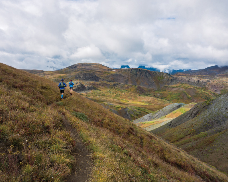
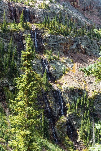
The Colorado Trail cuts a nearly 500-mile path across the southwestern part of the state, running from Waterton Canyon outside of Denver to Durango. Along the way, it dips and crests and unfurls across six National Forests, six Wilderness Areas, five river systems, and eight mountain ranges. The trail, which was completed by volunteers in 1987, tops out at 13,271 feet above sea level. A backpacker tackling the footpath from end to end will climb 89,354 feet over the course of its 28 segments. This challenge of craggy peaks, river basins, and elevation gain was one my ultrarunning husband couldn’t pass up.
The plan took shape in 2015 on a family camping trip to Wellington Lake outside of Bailey, where we spent a day hiking a verdant stretch of Buffalo Creek Trail (segment three of the Colorado Trail). It was there that we came upon a U.S. Forest Service sign championing the trail’s impressive physical attributes. My musing about writing a story on the Colorado Trail was all Heath needed to dream up a quest: The following summer he would run it section by section on weekends, and our family of four would camp along the path’s edge. It would be an unprecedented way to see Colorado; it would be an epic adventure.
After a short time on the trail that first day in May, I reluctantly turned around and ran back to the car. I needed to study our maps—a triangulation of the official Colorado Trail maps and guidebook, a Colorado atlas, and a state road map—and find my way over back roads half blocked by snow to the next meet-up point. There, at the South Platte River trailhead, the guys would need water and fuel to continue their 40-mile day, which was slated to end at Little Scraggy trailhead outside the town of Pine. This was a blueprint for how the summer would largely play out: a lot of running for Heath and Paul, and a lot of driving for Lisa, me, and the kids. They ran against the alpine sky. We followed them far, far below.
There were so many maps that they were falling off Paul and Lisa’s eight-person dining room table. Draping them over our forearms, we traced our fingers along the trail as it meandered from page to page. Every so often, a two-peaked triangular icon delineated the path—it was an image we would chase and find consolation in all summer long. Paul had taken a red Sharpie and charted our grand trek from beginning to end, circling potential camping spots, along with a 10th Mountain Division hut and a guard station cabin, in pencil. It was January 5, the night before recreation.gov opened up reservations for the season, and we were finalizing our campsites.
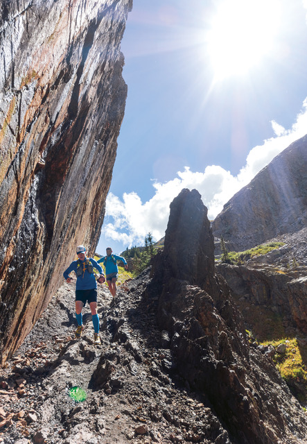
One thing became clear that evening: The closer we drew to Durango, the fewer the roads. This was problematic for two reasons. Heath and Paul would have to carry all their food and water each day because we wouldn’t be able to meet them partway with supplies. With most days totaling about 27 miles of often treacherous, high-elevation terrain, this was a significant concern, especially in areas so isolated they were devoid of cellphone service. The second realization was the amount of driving and navigating Lisa and I would be doing—without the aid of GPS.
One stretch in the San Juan Mountains had us driving three and a half hours one way while Heath and Paul ran 16 miles, which would take them less than two hours. After picking up the guys, we’d pile into the car again and drive six hours back to Denver. And what we didn’t know that evening—what no one-dimensional map could convey—is that many of the roads in the San Juans are impassable for a standard four-wheel drive like our Tahoe.
The next night, I sat on the floor of my living room, half buried by the same maps, the guide book, and our bible: an extensive, color-coded Excel printout with dates, locations, and their corresponding trail sections. With my computer, smartphone, and iPad, I began booking campsites the moment recreation.gov opened up reservations at 12 a.m. The house was silent save for the tapping on my keyboard, a sound punctuated by yelps as I discovered that many of our chosen sites were already reserved. I grabbed what I could, knowing we would have to revise some of our plans.
This would not be the last time we would have to hit reset. The reality was that we had chosen an especially difficult year to attempt the trail. It seemed only natural to make the journey in order of the numbered segments, beginning in Waterton Canyon in late April and ending in Durango over Labor Day. But in late January, we learned that Waterton would only be open to the public on Sundays (our plan was to run it on a Friday), which sent us to the Indian Creek trailhead outside of Sedalia, an acceptable alternative route. When it snowed four feet the weekend of April 15 and ski areas joyfully extended their seasons, we returned to our sea of maps, complicated calendars, and color-coded spreadsheet. We hadn’t even set foot on the trail, and it was already challenging us.
Vision, grit, and perseverance built the Colorado Trail. In 1973, Merrill Hastings of Colorado Magazine and Bill Lucas, a forward-thinking regional forester with the U.S. Forest Service, proposed building a “Rocky Mountain Trail” that connected Denver to Durango by one continuous, all-season route. Lucas, who managed one-third of the state’s forests, dreamed of a thoroughfare that, instead of functioning as a direct artery from one point to another, quietly meandered through or near a multitude of towns, historical sites, and ecosystems. Some people, he reasoned, would hike it from end to end, but most would access it for the day or an overnight, and so it needed to be accessible for a multitude of ages and abilities.
According to a 1974 Colorado Magazine story, Lucas thought it was feasible to link a number of established trails throughout the state, roughly 70 percent of which were already in place. He wagered that connecting this system of Forest Service trails, old game routes, mining and logging roads, and railroad grades, combined with digging new pathways, would take about three years to complete.

His passion to showcase Colorado’s diverse ecosystems, from low grasslands to high-alpine tundra, was twofold: It was as much an act of sharing the state’s wild and diverse beauty with the public as it was a reaction to the uptick in hikers nationwide. David Sumner, the author of the Colorado Magazine story, reported a 20 percent annual increase in recreational hikers between 1967 and 1973, with a projected upswing of 600 percent by 1998.
Even back then, in times that now seem vastly simpler than today, society was encroaching on the outdoors. “As this nation nears its Bicentennial, its historic trails—once lifelines of a civilization—have largely fallen into disuse,” Sumner wrote. “And in place of these great old trails we now have Interstate Highways whisking people from one nearly identical community to the next—insulating them at 60 mph from the land which is their birthright. If the Colorado Trail works out as planned…it could well mark a healthy reversal of this trend.”
Most important to Lucas, the Colorado Trail (as it was officially named in 1974) would be a path of the people: planned, built, and maintained by citizens. Groups of high school and college students completed much of the original scouting, and volunteers from around the country trekked mile after mile wielding pickaxes, rakes, and chainsaws in the name of a common goal. To this day, it is the responsibility of volunteers to help clear the trail of debris.

In all, it took 14 years and thousands of people surveying the land, hand-digging and leveling paths, removing obstacles, trimming trees and shrubs, and yoking together these various routes before the 486-mile trail was completed. On July 23, 1988, a ceremony in Durango, followed by a dedication in Waterton Canyon the next day, marked the launch of the Colorado Trail. Lucas, who died at the age of 88 in 2005, said, “[The Colorado Trail is] a legacy which will feed the quest for adventure, and precipitate the special dimension of life imparted by the spirit of the outdoors.”
When I was growing up, a toothy, ridged three-dimensional topographic representation of the Ten Mile, Sawatch, and Elk mountain ranges hung in my parents’ house. My hometown of Aspen sat deep in one of the plastic furrows, marked with a dot. Other tricolor maps, framed to set off their magnificence, adorned walls as functional works of art. To this day, my dad is quick to stand up mid-conversation and walk across the room to put his finger on a point and follow the jagged path of a mountain range or a river’s tendril as it wiggles across the page.

I felt a pang for my dad’s innate sense of direction on the morning of July 24 as Lisa and I smoothed the maps for segments 20 and 21 over the hood of our Tahoe. We were about two-thirds of the way through the journey. Our route from the difficult-to-reach Eddiesville trailhead to San Luis Pass outside of Lake City was a circuitous one over back roads that promised to be scenic—but also pockmarked and treacherous for lack of use. There was only one town along the way, and we prayed it had a gas station.
As usual, Heath and Paul had slipped away before first light, silently worming out of their sleeping bags into the dark to make coffee and instant oatmeal by headlamp. The night before, after finishing up a 27.5-mile day, they’d refilled their water bottles and stocked their running vests with energy bars, PB&Js, sunscreen, and a water purifier. Today they would run another 27.5 miles, with much of the terrain crawling across the horizon at more than 12,000 feet. Just before leaving, one of them would scrawl their departure time in my notebook and place it on the picnic table. It was the first thing Lisa and I would look for when we unzipped our tents and stepped into the daylight.
This morning, after a hurried breakfast and the beginnings of breaking camp, thin clouds cast mottled light over San Luis Peak at the end of the valley. It was just shy of 8 a.m. as we glanced at the gear that cluttered our campsite. The guys were likely nearing the top saddle, and we needed to get on the road.
Out where there’s no cell service, there’s power in relying on the rudimentary—maps and instinct and a healthy dose of crossed fingers—to find your way. In the city, immersed in daily routine, my intuition often felt fogged by the necessity of meetings and schedules and our myriad obligations. But out in the wild, there were no distractions; just the single, thoughtful mission of surrendering one place for the next. The unfolding of a map became a ritual that illuminated where we’d been and what lay ahead.
I followed Lisa’s SUV up and over the rugged road, hanging back and whooping when her sons rolled down their windows and pumped their fists as she forded the water crossings. As our caravan wound down from high plateaus onto a valley floor, I fingered the necklace around my neck. Some might think the charm a sideways zigzag or a chevron, but to me, the hand-hammered gold rises and falls like mountain peaks, like a mini suspended topo map. The piece was a birthday gift from my parents, sent six weeks before we started the trail, with a handwritten note that read, in part, “Remember where you’re from,” in my mom’s decisive script.
Two days before we started the Colorado Trail, I was standing onstage at the Paramount Theatre in downtown Denver with Eat Pray Love author Elizabeth Gilbert. We were singing John Denver’s “Take Me Home, Country Roads” in front of an audience of nearly 2,000. I’m not a singer, but when Liz asked if I’d wrap up our interview by joining her in song, I held the microphone to my lips and squawked out the lyrics she’d penciled onto a notecard…take me home…to the place I belong.
I had my first conversation with Liz seven weeks before we took the stage. I phoned her from inside my gray cubicle at 5280 to interview her about Eat Pray Love Made Me Do It, a 10-year-anniversary collection of essays written by readers deeply affected by her best-selling 2006 memoir. I never told her how much I loathed the book that rocketed her to worldwide fame, or that I found it self-indulgent and vapid. Instead, we talked about the larger theme of change—how it crystallizes and why it’s usually mired in denial. Long after we hung up, I sat quietly inside the walls of my cube, which were decorated with photographs, awards, and points of inspiration, and I contemplated her declaration that when the universe comes knocking, it does so politely at first. And then it kicks down the damn door.
The timing was prescient. My 20-year anniversary at the magazine was approaching. My position as food editor was enviable, and I loved its thrumming, nonstop pace. I was very good at my job, and my daily interactions with chefs and restaurateurs put me at the center of the city’s exciting, exploding dining scene. Even so, something tugged at me. What’s next? The whisper usually stayed at the margins, but when it surfaced, it was easier to bat away than to wrestle with. Why would I—how could I—leave a job that had become my identity? The entirety of my 20 years in Denver had been lived through the lens of 5280. Who would I be, and what would I do, if I left the only job I’d ever known?

And yet, my work-life balance was growing more askew by the day. During the week, Heath traveled for his job in health care, and I was often out four nights of every seven judging cooking events or dining at the latest and greatest. There was a 21-day stretch when I was home for dinner with our children just three evenings. Most alarming was that this pattern—and our revolving door of babysitters—felt dependably normal. Our go-to dinner of black bean tacos had become code for “sitter.” When I’d set a can of beans on the counter, Georgia would shrill, “Again?” and Ella would roll her eyes: “Who is it this time?” Between Heath and me, we never missed a game or a practice or a school event, but as we rushed from one thing to the next, we missed out on being a family.
Any chance we had, we fled to the mountains, to a place where the pace slowed and commitments fell away. That was a large part of the appeal of the Colorado Trail: The journey plucked us out of the city nearly every summer weekend and transported us to a space where we could think, where we could connect, where we could live instead of simply exist. The framework of forest and high-peaked views had become the keystone that kept our world upright. When weekends came to a close, Heath and I would look at each other, at our girls, and, already anxious about the coming week, speed back to Denver.
We had long talked about moving to the mountains. That was our end goal, our someday plan. But for Heath, the need to escape the city had become more pressing. With every passing trek to the mountains and each touchdown on the airport tarmac, Denver was becoming less and less a place to which he wanted to return. The buzz of the city and our daily chaos, once vibrant and exciting, was closing in with suffocating force. Home—which should have been an oasis of family and respite—was becoming a fleeting pit stop marked with babysitters and commitments. Armed with nothing but footsteps and his own thoughts to propel him along the trail over those summer weekends, Heath had time to dissect and reflect. He began to push for change, gently at first, and then more firmly. I refused to hear his plea. Our life was busy, yes, but it was full; this was no time to leave. I argued that the mountains were a future goal, not a present reality. But when Heath started looking, only half-jokingly, at real estate without me, I grasped the subtext. The fear of change sat like a stone against my heart. Could I reroute everything I knew? This time there was no map to unfold and study, no proven path to trace my finger along.
On Father’s Day, Heath called me. “I’ve got it,” he said when I picked up. We were driving back from the Food & Wine Classic in Aspen. I had left for the festival a day early, and Heath and the girls had followed. For the last week, I had done all I could to dodge interactions with my husband. Never before had we been at such odds, and I had the sense I was sinking. On this day, headed back to Denver, I was relieved to be driving in separate cars. Ella sat in my back seat, Georgia in his. Heath went on to explain his plan in detail, but I only heard: Sell our house. Pay off our debt. Move to his parents’ townhome in Keystone. I listened silently and let the tears slip down my cheeks. He hung up, and I clung to the steering wheel. It was Ella who picked up the conversation: “Mom, could we really do that? Could we really move to the mountains?”
On the trail, Heath, Paul, Lisa, and I never failed to celebrate the golden hour. We sent the kids off to play in the woods, and under the early evening sun’s liquid light, we sipped cooler-cold beer and cocktails mixed from our makeshift bar and chilled with precious ice cubes. Soon enough it would be time to make dinner, but this was our chance to recount the day—what had gone right, what had gone wrong—and anticipate what tomorrow might look like.
But on the evening of Friday, July 22, near the start of segment 17 in south-central Colorado, I sat alone on a soft berm overlooking a sliver of Brewery Creek. I hugged my knees to my chest and sipped a beer in the evening light. Behind me was the two-room guard station cabin we had reserved for the night, but it was temporarily empty. Heath had made a supply run to Villa Grove, a miniscule town 15 miles down a dirt road, and the Landrys had yet to arrive from Denver. We had a big weekend ahead with the guys running segments 17 to 21 for a total of 75.4 miles. In the coming days, we would enter the rugged, often formidable San Juans. But as I got to my feet and walked into the incandescence, I wasn’t mulling over that journey. I was thinking of another.
That morning before leaving Denver, I slid a stamped envelope addressed to Elizabeth Gilbert into our mailbox. Inside was a note thanking her for encouraging me to listen to the prodding, open-ended question that had haunted me for months. What’s next? I didn’t send the letter expecting a response. I already knew my answer. Weeks of hand-wringing and debate had made clear that if I didn’t look forward, I was choosing the comfort of routine, wild as it was, over the needs of my family. And, most painfully, I felt I was losing part of Heath. I had to trust in the unknown and have faith that there was value beyond the life we currently lived. I had to believe that the mountains would prop me up and offer a different kind of fullness.

Heath’s plan had become our guide: We would sell our house, pay off our debt, and live in my in-laws’ condo in Keystone for the short term. Heath would keep his job and add me to his health insurance; I would move to freelance writing. “Keystone” rolled through my head as I took in another sip of beer and the meadow before me. I shook my head in disbelief. The very word means support, infrastructure, and foundation. It’s just what we were seeking, and what our children craved. I was certain that in this refractive moment of silence and gratitude, the universe nodded its quiet approval. Take me home…to the place I belong. I raised my face to the sky and whispered, “Thank you.”
Just as quickly as we finalized our decision, we had to act. We had one month before the girls would start school (which we had yet to pick out), a life to pack up and move, friends to hug goodbye, and 127 more trail miles to complete. The pace didn’t leave a moment for second-guessing. A “Coming Soon” sign went up in the front lawn of our Congress Park home, and Heath met with the movers the same day I put in my notice at the magazine. I trembled at the thought of leaving the safety of 5280’s walls, but it was time. I would find my own way, just as the trail, with its long ribbon of peaks and valleys, twists and turns, had already delivered us to places unbidden and unexplored.
By the time we reached the end of the trail six weeks later, the life we knew had been remapped, dismantled, and carted to storage. Our house went under contract while Heath and Paul were completing segment 23 of the trail; Lisa and I four-wheeled to the top of 12,592-foot Stony Pass, collected the guys, and raced down the craggy road to Silverton to sign the papers. The girls started school in Summit County and were making new friends. Heath and I had celebrated our 11th wedding anniversary on segment 15 outside of Salida, though in truth, I was so emotionally raw I could barely muster a smile. I was, at turns, grateful and elated by our good fortune and completely paralyzed by what we’d done. But Heath was there leading the way, encouraging me to look into the distance to see the peaks.
Lisa, the kids, and I milled about the Junction Creek trailhead three-and-a-half miles northwest of Durango. The kids threw rocks in the river, chased a terrified garter snake, and picked on each other. Lisa and I checked our watches every few minutes and craned our necks for a view farther down the trail. Our cameras were ready. This was it; these were the last dusty steps of the trail. When Heath and Paul crossed the invisible finish line, they would have run more than 500 miles (complete with missteps and backtracking) in 21 days spread out over nine weekends. Two chilled bottles—bubbles for the adults and Martinelli’s for the kids—sat in the shade nearby.
At last, we saw flashes of green and purple shirts coming through the trees. Jack got to the guys first, catching Paul in a bear hug and giving high fives as Heath ran to engulf me. Ella and Georgia screeched and scrambled up from the riverbed to throw their arms around us. Moments later, Lisa and I filled plastic cups with cheap champagne and sparkling apple juice and handed them around. The eight of us raised our glasses to the mountains above and toasted—to the end and to a beginning.


