The Local newsletter is your free, daily guide to life in Colorado. For locals, by locals.
Length: 6.2 miles round trip
Difficulty: Moderate

Why we love it: One of the area’s most popular outings, this trail climbs steeply up to the top of a plateau, where a series of overlooks offer some of the best views in Durango
When to go: May through November, as long as the temperatures are moderate
Pre-hike buzz: Before you head out, grab some locally-roasted coffee at the Durango Coffee Company on Main Avenue
Restrooms: None
Dogs: Must be leashed
The next time that you find yourself in Durango, be sure to check out the Animas Mountain Loop, a trail that’s popular with local hikers, joggers, and mountain bikers because it offers both a great workout and fantastic views, especially of the Animas River, the most important in the area. The name of the river and this mountain both come from the Spanish phrase, “the river of lost souls.”
From the parking area, the trail climbs steeply up the mountainside for the first half mile. The rocky terrain and snaking switchbacks make this a challenging, technical ascent for mountain bikers, but pose few problems for hikers and joggers. At the end of the climb, you reach one of several trail junctions with maps showing your location. From here several loops are possible, but to reach the viewpoints, you’ll want to just keep heading to the right (east).
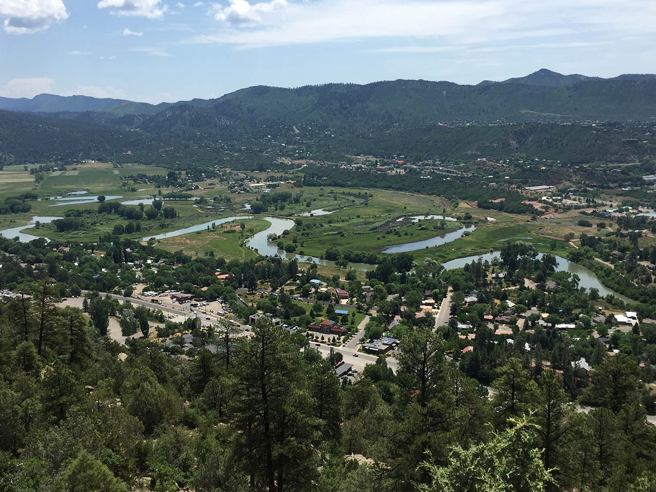
The trail continues to climb, although not as steeply, up the plateau until you reach its eastern edge, where two viewpoints in quick succession offer amazing panoramas down into the Animas River valley. You can see the town nestled in the bottom, as well as several oxbows, loops of the river that were cut off from the main channel after the river carved a newer, shorter course. These wetlands provide important habitat for migrating birds and other wildlife.
From these overlooks, continue up the trail, heading east at the junctions, to access two more fabulous overlooks. From this point onward, the trail turns west to wrap around the mesa’s northern edge, leading to a final viewpoint that looks north, towards the towering La Plata Mountains.
To finish the loop, continue to follow it south from this last overlook. The trail winds through sparse ponderosa pine forest, with increasing amounts of Gambel oak the more you drop in elevation. Near the end, proceed straight through two more trail junctions to enjoy one last overlook to the southeast. From here, take one of the next two trail junctions to the left (east) to rejoin the switchbacks on their final descent to your vehicle. If you prefer a shorter hike, you can walk to the first or second viewpoint overlooking the river, then simply retrace your steps.
Getting there: From downtown Durango, head north on Main Avenue to 32nd Street. Turn left onto 32nd and drive to its end at a T-junction. Turn right here and go straight for a couple of blocks to a dirt parking area.


