The Local newsletter is your free, daily guide to life in Colorado. For locals, by locals.
Length: 14 miles round-trip with a gain of 4,300 vertical feet
Difficulty: Most difficult
Why we love it: Trek to the top of America’s most-visited mountain (by foot)—and enjoy a doughnut when you arrive.
When to go: Late June through September when the route is clear of snow
Pre-hike Buzz: Skip the coffee to get an early start and instead pick up a cup at the Summit House, located on the top of the peak.
Restrooms: Outhouse at the trailhead and flush toilets at the summit
Dogs: No restrictions
In 1806, Lieutenant Zebulon Pike became the first Euro-American to see the magnificent mountain that soars 8,000 feet above today’s bustling city of Colorado Springs. Although Pike attempted to climb it, the waist-deep snow soon caused him to turn around and declare the mountain unclimbable—a prediction disproved just 14 years later when another party made it to the top.

Today about 600,000 people visit the summit of Pikes Peak each year, although the vast majority get there via the cog railway or driving up the paved Pikes Peak Highway. For those wishing to journey to the top on your own two feet, the Northwest Slopes is a “backdoor” route that offers a shorter alternative to the grueling Barr Trail but still gives you the opportunity to earn another fourteener summit.
From the Crags/Devil’s Playground trailhead at 10,000 feet, follow the well-constructed Devil’s Playground Trail up a series of switchbacks and then slightly down to a junction about half a mile from the trailhead. Turn right at this junction to continue on the Devil’s Playground Trail (#664A), which immediately crosses a small creek on a hewn-log bridge.
The trail climbs gently—and then steeply—up to and above treeline until it reaches the top of a slope about 2.5 miles from the summit. Here, the trail contours around the top of a bowl along an old dirt road and then passes through a notch of granite that resembles a stack of pancakes. A few hundred yards after passing through this notch, the trail reaches the paved Pikes Peak Highway. After crossing the road at a striped pedestrian crossing, the route begins to traverse a long, exposed ridge.
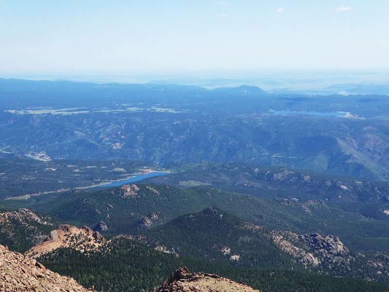
The trail parallels the road much of the way to the summit block, where you diverge from the road to follow a trail marked by cairns that weaves through the boulder field for the last 500 vertical feet to the top. Once on the summit, you’re treated to amazing views of the Great Plains stretching along the horizon and the so-called “Bottomless Pit,” the mountain’s most spectacular glacial valley.
And unlike most (OK, all) fourteeners, Pikes Peak offers its very own snack shop. The Summit House is best known for its high-elevation doughnuts, but you can also pick up a burger, hot dog, or other snacks here. You’ll probably be hungry after that climb.
Unless you conned a friend into driving you back to your car, retrace your steps down America’s Mountain while marveling at the natural beauty that inspired the stirring lyrics of Katharine Lee Bates’ patriotic song, “America the Beautiful.”
Getting There: From Woodland Park, head west on U.S.-24 to the town of Divide. At the junction with CO-67, turn left (south) and follow CO-67 for 4.2 miles. Next, turn left onto a dirt road signed for the Rocky Mountain Mennonite Camp. Follow this 2WD-accessible road for 3 miles to the Crags/Devil’s Playground trailhead, which has a large parking area.
Logistics: The first-come, first-served Crags Campground near the trailhead makes an ideal base, but check first to make certain that it’s open. There’s more camping available about 5 miles away at Mueller State Park. It’s especially important to get a crack-of-dawn start on Pikes Peak to minimize the chances of thunderstorms along the upper route’s long, exposed ridge. For safety considerations, detailed route descriptions, and recent access and trail conditions, visit 14ers.com.
(Check out 5280‘s Ultimate Guide to Hiking Colorado’s Fourteeners)


