

The Local newsletter is your free, daily guide to life in Colorado. For locals, by locals.
Centennial State residents are notorious for our love affair with Type II fun. We hike 14,000-foot peaks, endure 20-mile trails, and take part in other activities wherein the actual endeavor is a total sufferfest but which we’re then able to talk about (ahem, brag about) over craft suds and much-deserved nachos at the local microbrewery. That’s great—for us. For our relatives visiting from Florida or best friend in town from Ohio, it’s, uh, less great. And by less great, we mean someone might end up in the ER.
We’re here to help with hikes that will allow you to show out-of-towners the beauty of Colorado on trails that won’t leave them wheezing—or at least not too much. All eight options, located within a 90-minute drive from Denver, are relatively short, feature mild elevation gains (mostly), and still have a standout element (often more than one) that should work its way onto your pal’s Instagram recap. So lend your hiking partner a backpack (or swing by a local retailer so they can snag a functional souvenir) and get out there (if possible, after they’ve had a day or two to acclimate).
Before you go: Always remember to check the weather, carry plenty of water along with the rest of your 10 essentials, and wear the appropriate apparel. Local rangers advise downloading the Colorado Trail Explorer (COTREX) app, which includes trail maps and trail closures, ahead of your hike.
Jump Ahead:
- Green Mountain West Ridge Trail, Boulder
- Dinosaur Ridge Trail, Morrison
- Devil’s Backbone Wild Loop, Loveland
- Flatirons Vista Loop, Boulder
- Central City Cemetery, Central City
- Lily Lake Trail, Estes Park
- Seven Falls, Colorado Springs
- Fowler Trail, Boulder
- Arthur’s Rock Loop, Fort Collins
- Mt. Sanitas, Boulder
Green Mountain West Ridge Trail, Boulder
- Low output: 3.2 miles out and back, 600 feet of elevation gain
- High reward: A bagged peak and the not-so-hard-earned panoramas to go with it
- Scenario: Your visitor wants to hear what John Denver made such a fuss about.
- Hike beta: Send to your phone.
The late-great crooner and former Aspen resident sang about Rocky Mountain highs for a reason—the sight from the top of a peak is unparalleled. It’s more the perpendicular part that poses an issue. The Green Mountain West Ridge Trail dodges the elevation gain (and the crowds in Chautauqua) and gets pretty quickly to the 8,100-foot climax. After winding through an evergreen forest and high stepping to the summit, you’ll be treated to expansive views out across the Rockies to the Continental Divide. Refer to the metal peak-finder plaque located at the tippy-top to identify Mt. Audubon, North and South Arapahoe Peaks, and plenty more summits in the distance. (Those, however, will be harder to reach.)
Expert tip: Famous Grouse Whiskey drinkers will appreciate meeting the infamous grouse who’s been known to hang out at the apex. Non-whiskey drinkers will get a kick out of this cantankerous (and territorial) bird, too.
Dinosaur Ridge Trail, Morrison

- Low output: 2.2 miles out and back, 300 feet of elevation gain
- High reward: An opportunity to see Cretaceous Period tracks and Jurassic Period bones that would wow the likes of Dr. Alan Grant
- Scenario: Your niece and nephew are going through the dinosaur phase.
- Hike beta: Send to your phone.
Stegosaurus and Allosaurus bones, prehistoric crocodile tracks, even ancient scratches from where dinos got their Marvin Gaye on: The Dinosaur Ridge Trail has it all, and it’s free and within steps of a traffic-controlled road. (Guided bus tours are the only vehicles allowed.) Start at the Main Visitor Center and be sure to read the 15-plus educational nodes located along the path for insights into what ancient marvel stands before your crew. Return the same way to your car.
Expert tip: Reward the kiddos at the end of the hike (or bribe them to get there) with dino replicas and rocks aplenty for sale at the Main Visitor Center.
Devil’s Backbone Wild Loop, Loveland
- Low output: 2.4 miles round trip, 330 feet of elevation gain
- High reward: Hike through a natural keyhole.
- Scenario: Your younger sister heard about the Longs Peak Keyhole Route on TikTok, but you don’t want an emergency room detour to make you late for your dinner reservation.
- Hike beta: Send to your phone.
Despite this destination’s rather imposing name, Loveland’s take on rock windows is actually quite approachable. From the Devil’s Backbone parking lot, mosey through a small grove of cottonwoods, where you should keep your eyes and ears perked for Bullock’s orioles, eastern and western kingbirds, and, if you hike at dusk, great horned owls. Veer left to follow the suggested directional signs, walk along the remnants of a historic irrigation canal (the digging of which led to the discovery of a gypsum deposit), and find vistas out to Longs Peak perfectly framed by a keyhole naturally carved out of orange Dakota sandstone. (Watch out for rattlesnakes.)
Expert tip: Go in the morning or early evening to find a parking place, dodge the crowds, and beat the heat; there’s little shade on this trail other than the cottonwoods near the trailhead.
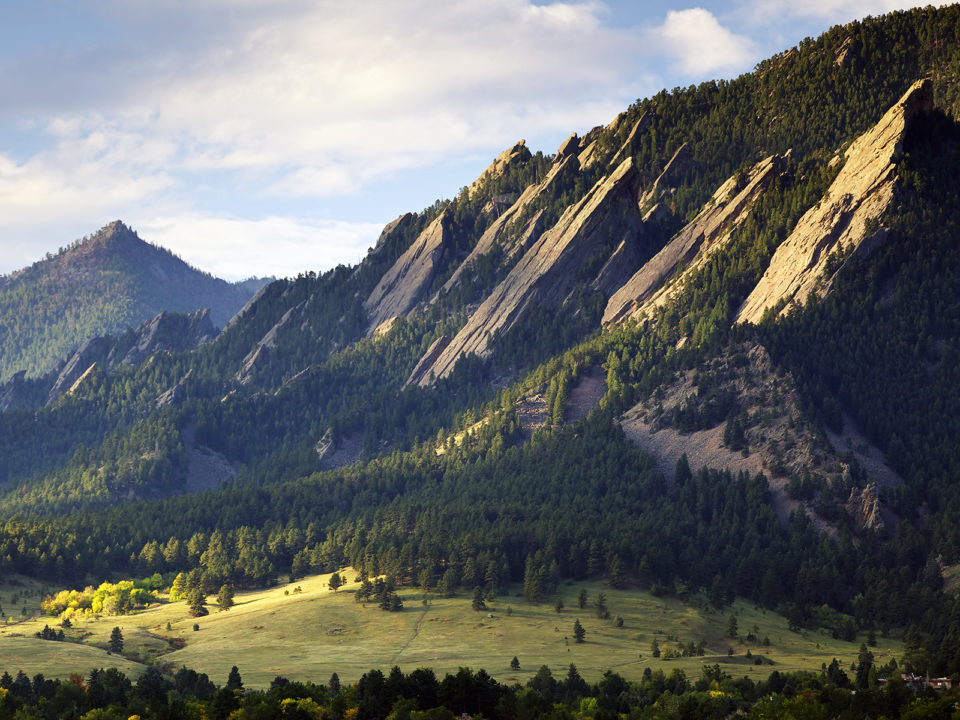
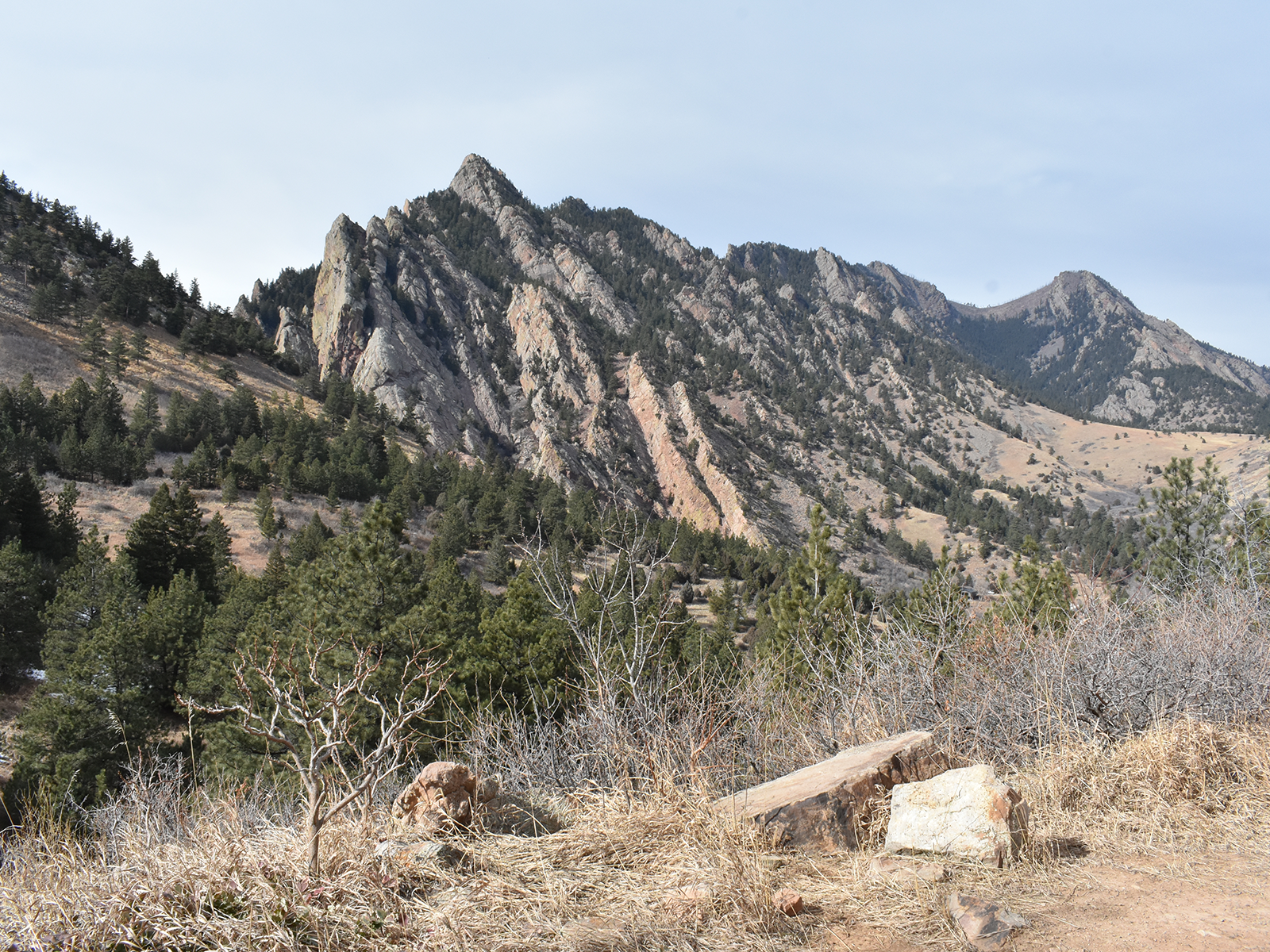
Flatirons Vista Loop, Boulder
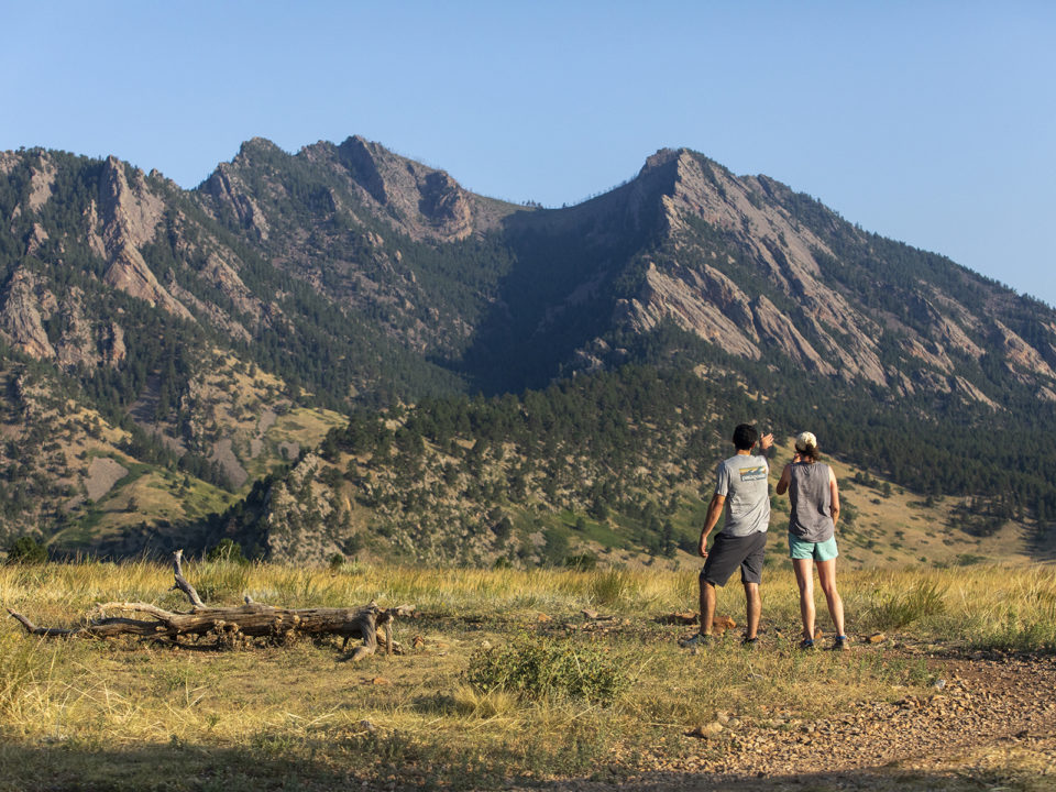
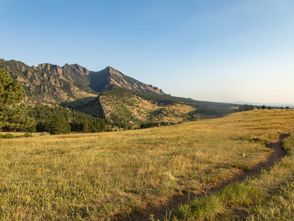
- Low output: 3.8 miles round trip, 430 feet of elevation gain
- High reward: Million-dollar eyefuls of Boulder’s famous formations
- Scenario: Your parents are in town and eager to see why you chose the University of Colorado Boulder.
- Hike beta: Send to your phone.
Since Buffs football tickets are too expensive (and practically impossible to secure anyway), show your visitors the other reason they’re forking over so much in tuition fees. The Flatirons Vista Loop offers spectacular views across undulating hills to Boulder’s iconic rock slabs—and the backdrop in countless university promo pamphlets. Though the Flatirons are visible for nearly the entire duration of the hike, take the Flatirons Vista South Trail southwest to the junction with the Flatirons Vista North and Doudy Draw paths for your parents’ new Facebook profile pic. Follow the Flatirons Vista North Trail back to the parking lot.
Expert tip: The Flatirons Vista trailhead parking area is closed for construction improvements (trails are still open), expected through June 2026. Instead, park at the Greenbelt Plateau trailhead just north off CO-128 and hike 0.4 mile on the Greenbelt Connector to pick up the loop.
Central City Cemetery, Central City
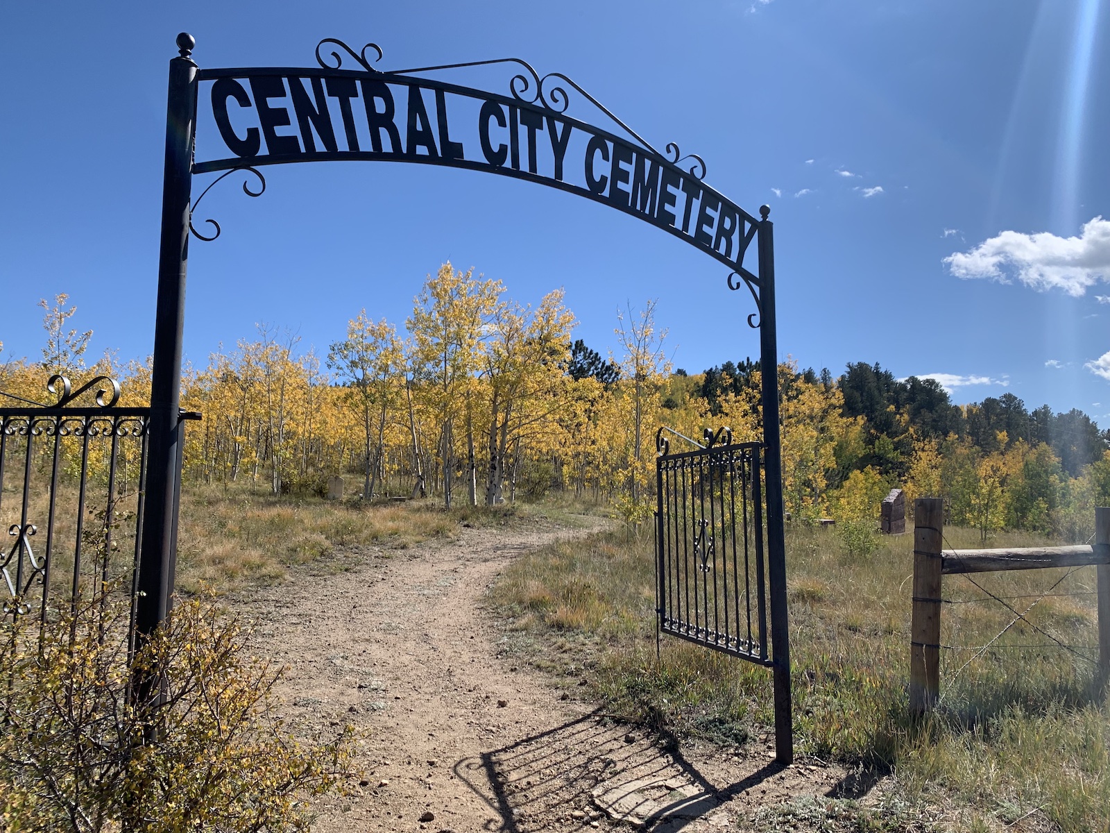
- Low output: As long or short as you want with optional climbs
- High reward: Eerie vibes from Colorado’s mining past
- Scenario 1: Your high school friend has a thing for ghost stories.
- Scenario 2: Your long-distance beau is in town, but you’re looking for a place to end the relationship.
Whether you’re looking for a glimpse of the mysterious Lady in Black or appreciate the slightly macabre symbolism of burying a relationship on a gravestone-covered hillside, a hike through Central City Cemetery is just what the coroner ordered. To get to the cemetery’s iron-gated entrance, drive past Central City’s take on the Strip to where Eureka Street turns to dirt. From here, you can amble through aspen woods and around tombstones dating back to the late 1800s, most from the area’s rich mining days, while still getting those sought-after mountain views.
Expert tip: Go in the fall to find a less-crowded place to leaf peep and to get into the Halloween spirit.
Lily Lake Trail, Estes Park
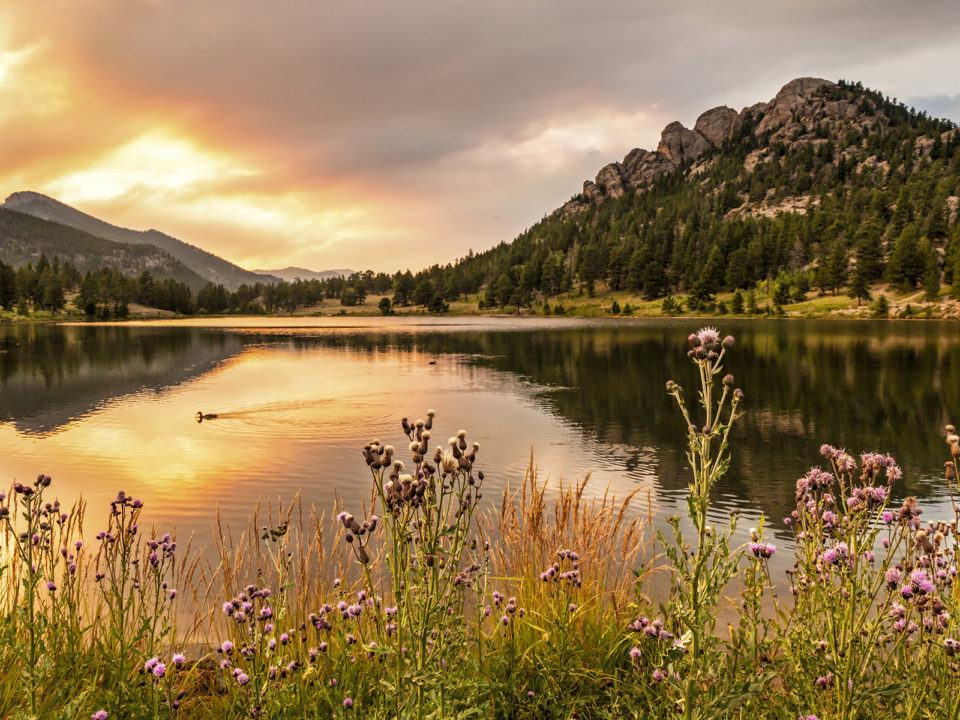
- Low output: 0.8 mile out and back, 40 feet of elevation gain
- High reward: Rocky Mountain reflections in an alpine lake
- Scenario: You remembered to get a timed-entry permit for Rocky Mountain National Park but the Bear Lake add-on was already sold out.
- Hike beta: Send to your phone.
The Bear Lake Trail is arguably our backyard (national) park’s most beloved stroller-friendly, well, stroll, but Lily Lake is a great alternative (and will save your crew nearly 30 minutes in the car). Begin at the trailhead just off Highway 7 and take your time circling the water while Longs Peak, Mt. Meeker, and the Twin Sisters tower overhead. If the wind is at a standstill (admittedly, rare in Rocky Mountain National Park), look for the reflections of their fellow peaks dancing across the water.
Expert tip: Since the Lily Lake Trail is part of Rocky Mountain National Park, make sure to pay the park entrance fee or flash your annual pass.
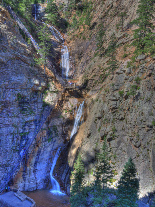
Seven Falls, Colorado Springs
- Low output: 1.6 miles out and back; the hike is flat and the (224-step) climb is optional.
- High reward: An 18-story waterfall
- Scenario: Your entire extended family just descended on the Broadmoor for an annual reunion and everyone needs some fresh air to dilute Aunt Rita’s overpowering perfume.
- Hike beta: Send to your phone.
Seven Falls has drawn family vacationers since the late 1800s. Back then, a local entrepreneur charged $0.25 a pop for a ride by carriage, horse, or burro through the box canyon to witness the impressive cascade. The entry fee is a little higher now ($21 for adults, $15 for kids, $18 for seniors), but the experience of watching water gush down 181 feet is worth every penny. Family members can opt to remain at the base, but those who huff up 224 iron steps will get a chance to see all seven falls—named Ramona, Feather, Bridal Veil, Shorty, Hull, Weimer, and Hill—from a closer vantage.
Expert tip: Dodge a case of the hangries on the return trip with red trout or a bison steak from Restaurant 1858, located near the waterfall’s base.
Fowler Trail, Boulder
- Low output: 3.4 miles out and back, 400 feet of elevation gain
- High reward: Never-ending views of Eldorado Canyon’s sheer cliffs, plus stationary telescopes along the trail to watch the brave souls scaling them
- Scenario: Your dad just watched The Dawn Wall and wants to see some rock climbing in person.
- Hike beta: Send to your phone.
If you’re tight on funds and can’t swing the $10 daily vehicle fee for Eldorado Canyon State Park, this easy out-and-back delivers the same sandstone drama—for free. The route begins on Boulder Open Space and Mountain Parks land, with a hogback ridge of sandstone cliffs rising to your right. About 1.3 miles in, you’ll cross the boundary into the state park—no fee required—and pick up a stretch of shade before the trail emerges inside the canyon. We suggest packing a lunch and posting up on one of the picnic benches beside a stationary telescope. From there, watch rock climbers scale the opposing cliff—like a live-action screening of The Dawn Wall.
Expert tip: Skip the futile crawl for a “perfect” parking spot near the top of County Road 67. Instead, park at the first legal pullout you see and walk the few extra minutes. It’s cheaper and faster (and far less frustrating). —Jessica Giles
Arthur’s Rock Loop, Fort Collins
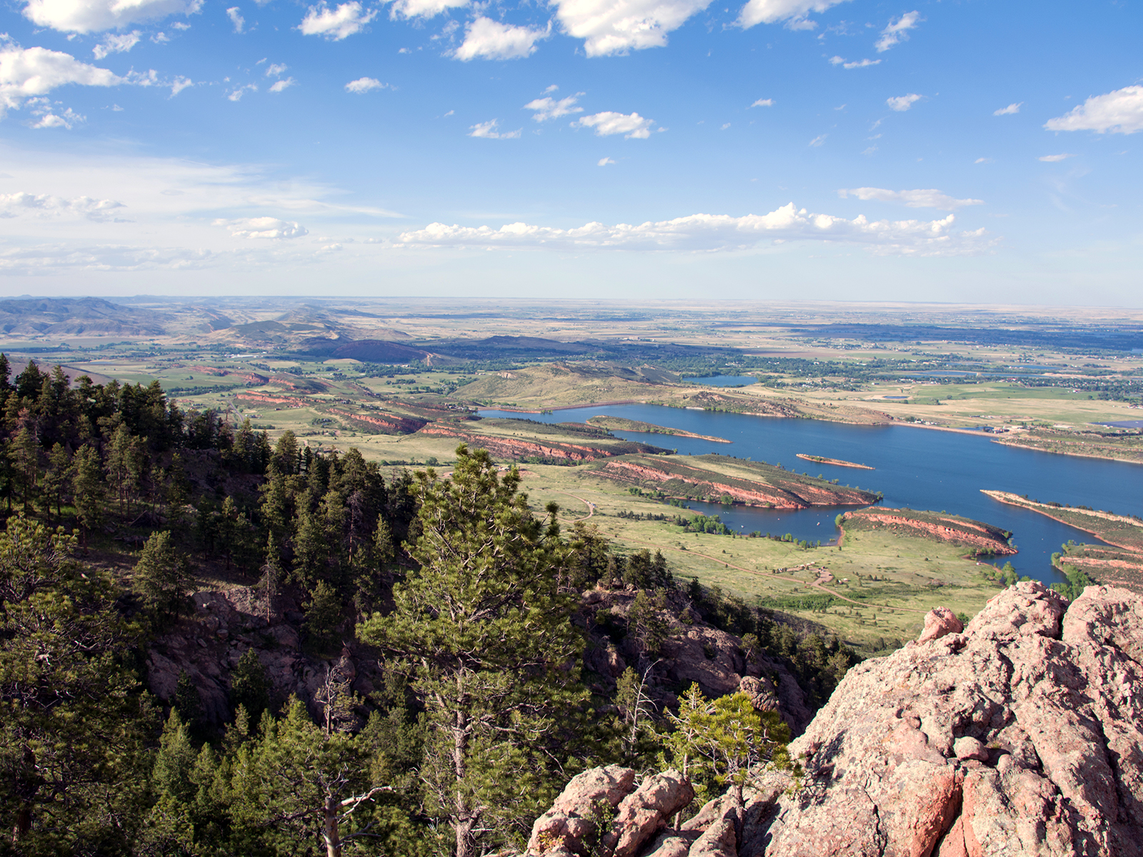
- Low output: 4.5 miles round trip, 1,100 feet of elevation gain
- High reward: A chance to see two states from one peak
- Scenario: Your in-shape college pal is here and requesting a “hard workout.”
- Hike beta: Send to your phone.
True, they asked for a hike to get their heart pumping. You also don’t want to hospitalize them (or wipe them out before your Red Rocks show). Find middle ground with a challenging romp to Lory State Park’s high point, Arthur’s Rock. Shortly past the trailhead, you’ll pass a small waterfall to whet their palate for adventure before continuing up, up, and away. In early spring, columbine, lupine, and mariposa lilies will distract them from their barking quads; in summer, bright-green hillsides framing Horsetooth Reservoir, buzzing with wakeboats. Be sure to go all the way to the top, rangers say, to see out across the Colorado plains and north into Wyoming.
Expert tip: Refuel post-hike with a “Deluxe” Gutbuster from Big City Burrito, a favorite grab-and-go joint for Colorado State University students—and those of us reliving our glory days.
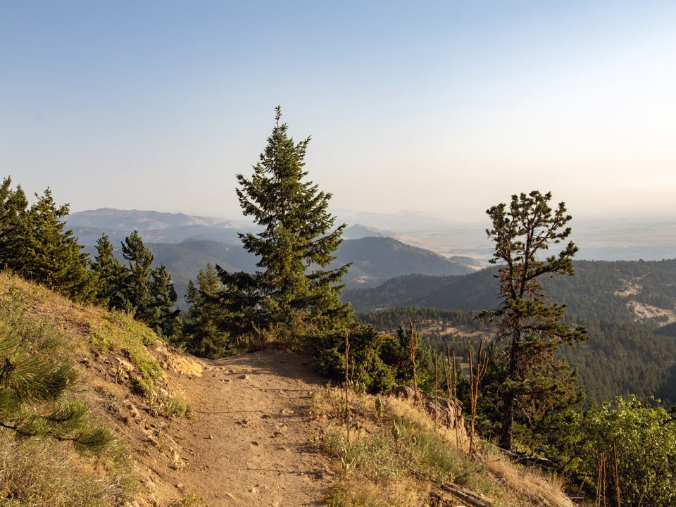
Mt. Sanitas, Boulder

- Low(ish) output: 3.4 miles round trip, 1,720 feet of elevation gain
- High reward: Bag the pearl of Boulder—and see clear to Denver and Pikes Peak
- Scenario: Your Instagram-savvy pal wants a trophy to augment her social media clout (and she can handle an hour on the stair-climber).
- Hike beta: Send to your phone.
Stop! Stop right there! The first 1.2 miles of this hike gain a hair over 1,200 feet of elevation, which means you’re essentially on a StairMaster for an hour (take a six-inch-high step each stride). That is decidedly not easy. But if you’re showing off the home front to, say, your former college roommate and not your elderly grandparent, Mt. Sanitas, the fifth (going north) of the five main peaks comprising the Boulder horizon, delivers one of the quickest payoffs on the Front Range. In an hour of work, you’ll scoot up singletrack pocked with staircases that make quick work of a relatively direct shot to the summit, where the view stretches from Fort Collins to Colorado Springs with highlights including the Denver skyline and airport in between. From the top, coast down the East Ridge and Valley trails, easy-breezy paths with gunsight-views to the Flatirons. It’s two hours car to car—but don’t compare your time to Strava.
Expert tip: Forget street parking near the trailhead; park at Sunshine Canyon, a short walk up the main road. A dusty parking lot with a couple of pit toilets has more room. And this one gets brutally hot around midday. Start early. —Maren Horjus


.jpg)