


The Local newsletter is your free, daily guide to life in Colorado. For locals, by locals.
Summertime in Colorado’s high country is nothing short of magical. When the Rocky Mountains’ annual melt grants full access to the backcountry, there’s no limit to the adventures Centennial Staters can undertake. And while summiting thirteeners and fourteeners, accessing high mountain passes, and two-wheeling along singletrack are tantalizing endeavors, time spent relaxing at a pristine alpine lake may have all of them beat. Defined as bodies of water at or above 10,000 feet, alpine lakes are plentiful in Colorado, which boasts more than 2,000 of these high-country jewels.
Slather on the sunscreen, grab your telescoping fishing rod, and trek up to one of these 12 beauties while alpine season lasts.
Jump Ahead:
- Island Lake, San Juan National Forest
- Lake Haiyaha, Rocky Mountain National Park
- Lake Agnes, Arapaho National Forest
- Upper Mohawk Lake, Arapaho National Forest
- The Loch, Rocky Mountain National Forest
- Snowmass Lake, Maroon Bells-Snowmass Wilderness
- Mystic Island Lake, Holy Cross Wilderness
- King Lake, Indian Peaks Wilderness
- Comanche Lake, Sangre De Cristo Wilderness
- Parika Lake, Arapaho National Forest
- Chihuahua Lake, White River National Forest
- Crater Lakes, James Peak Wilderness
Island Lake
- Trail length: 7.7 miles, round trip
- Distance from Denver: 356 miles
- Closest town: Silverton
- Trailhead: Ice Lakes
This hike into the wilds of the San Juan National Forest will net you three lake views for the price of one relatively strenuous—but absolutely stunning—trek. Beginning from the South Mineral Campground, just a few miles from downtown Silverton, the first 2.2 miles of the path are fairly painless, although you’ll be breathing hard due to the elevation, which is about 9,800 at the trailhead.
When those first two miles are up, you’ll be standing at the banks of Lower Ice Lake, a pretty enough lake in a spectacular basin replete with pine trees, waterfalls, creeks, and cliffs. (This is where you might consider pitching a tent, if you’re making this an overnight trip.) From here, the trail climbs dramatically—roughly 750 feet in one mile of rocky terrain—to Upper Ice Lake, a glacial tarn whose waters look like blue Gatorade. You might be satisfied to stop your hike here; after all, how could any lake be more beautiful than Upper Ice Lake?
Let us introduce you to Island Lake, only a half mile farther. A cerulean tarn with a small island, it’s surrounded by 13,000-foot peaks. Hikers can walk around the lake, or climb to Grant-Swamp Pass for a bird’s-eye view. —Sarah Banks
Lake Haiyaha

- Trail length: 4 miles, round trip
- Distance from Denver: 84 miles
- Closest town: Estes Park
- Trailhead: Bear Lake
You’ll actually bag four alpine lakes along this short but sweat-inducing trail in Rocky Mountain National Park, but the best is undoubtedly Lake Haiyaha: an otherworldly aqua tarn at mile two. Early risers are more likely to be rewarded with a parking spot at the Bear Lake trailhead, but don’t fret if you’re not feeling a 3 a.m. wake-up call. You can always take the free shuttle from the park-and-ride to the trailhead.
Almost immediately after embarking from the parking lot, you’ll pass Bear Lake—a popular fishing hole speckled with lily pads and teeming with rainbow trout. Enjoy a leisurely, partially paved ascent until you hit Dream Lake, a little over a mile in, before it’s time to climb. The towering lodgepole pines provide generous shade while you work for the vistas to come, the first being a bird’s-eye view of Nymph, Bear, and on clear days, even Bierstadt Lakes. Get a reprieve from the grade shortly after this lookout, when the trail levels out and winds through one final section of thick forest.
As the dirt path gives way to boulders, brace yourself for the finishing scramble. While you’re busy playing nature’s version of Twister on the jigsaw puzzle of boulders, don’t forget to look up: Lake Haiyaha seems to materialize from the mountains. Its turquoise-tinged waters are the main draw, but be sure to spend some time scanning the rim of the lake, which is sentineled with statuesque limber pines whose roots snake over the stones. These are some of the oldest trees in the park. When you’ve gotten your fill of nature’s splendor, return the way you came. —Jessica Giles
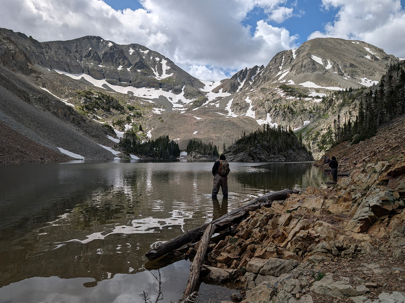
Lake Agnes
- Trail length: 2.3 miles, round trip
- Distance from Denver: 135 miles
- Closest town: Walden
- Trailhead: Parking lot off of County Road 62
If you don’t want to schlep it all the way to Silverton to see a lake with an island in the center, head to this lesser-known lagoon (with a mere 446 feet of elevation gain) hidden in State Forest State Park. Low-clearance vehicles should park at the lot right off County Road 62, but if you’ve got the wheels, continue another mile down the dirt road to claim a spot at the upper lot by the trailhead.
The route begins with a picturesque walk past streams and a burbling waterfall that emerges from a snowfield. Keep an eye out for antlers: This is where you might spot a moose, if you’re lucky. (Nearby Walden is known as the moose capital of the state.) Around 0.2 miles in, ascend a series of long, gradual switchbacks. Don’t panic; you only climb for about 0.4 miles before the trail dumps you out on the shores of Lake Agnes at 10,600 feet.
Mountains flank the tarn on all three sides: Mt. Richthofen to the south, Mt. Mahler to the west, and the Nokhu Crags to the east. Even in the summer months, you might catch some backcountry skiers sneaking in turns in the couloirs of Mt. Richthofen. Although you can’t swim in this high-altitude watering hole, fly-fishing is permitted and the water teems with minnows, so pack a rod. For 360-degree views of the iconic island rising from Lake Agnes, follow the trail around the circumference—but be prepared to do some scrambling on the east side. After a quick break for snacks (or snapshots), follow the Lake Agnes Trail back the way you came. —Sean Parsons
Upper Mohawk Lake

- Trail length: 6.8 miles, round trip
- Distance from Denver: 84 miles
- Closest town: Breckenridge
- Trailhead: Spruce Creek (there is a four-wheel-drive parking lot a short distance past the main parking area)
Just south of Breckenridge, the Spruce Creek Trail to Upper Mohawk Lake is a popular one. And for good reason: It’s strenuous, but not too strenuous, and it’s got some of the most beautiful alpine scenery you’ll find anywhere in the state. At the start of the route, you’ll hike through forests of lodgepole pines and aspens before passing an old miner’s cabin and Mayflower Lakes, where you can take a water break. The trail gets steeper after that as you pass Continental Falls en route to Lower Mohawk Lake. (If you fish, you might want to get your line wet in the shallow waters here.)
The trail again ramps upward after Lower Mohawk Lake, and as you approach Upper Mohawk Lake, you will find wide open views of a postcard worthy high alpine gulch. In the distance, you’ll see the dramatic summit of Pacific Peak, which tops out at 13,950 feet, but take a few minutes for some trail mix and a drink alongside the deep blue-green waters of Upper Mohawk Lake. You can double back to your car from this point, but if you’re interested, there are three more unnamed lakes past Upper Mohawk, all of which are worth the extra effort. —Geoff Van Dyke
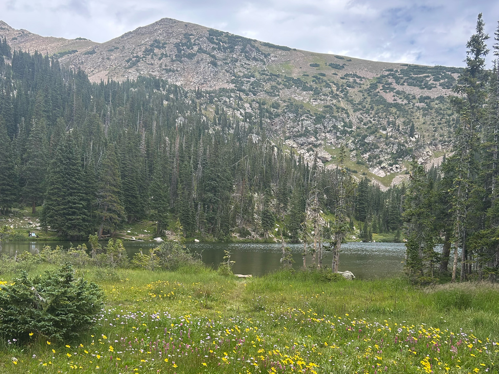
The Loch

- Trail length: 5.4 miles, round trip
- Distance from Denver: 83 miles
- Closest town: Estes Park
- Trailhead: Glacier Gorge
Perhaps one of the most underrated alpine lakes in Rocky Mountain National Park, the Loch is often overshadowed by nearby Bear Lake or Sky Pond. But because it’s usually just a passing-through point for park-goers, rather than a destination, it can feel like an oasis all your own. Like Lake Haiyaha, you can ride the free shuttle from the park-and-ride to Glacier Gorge trailhead, so parking isn’t a problem.
The trail kicks off with some fairly steep stairs but don’t stress, most of your mileage is a gradual incline. At the top of the steps, bank left for the Loch. Just a little over half a mile in, the path joins up with Glacier Creek for a serene stroll along the gurgling stream. (It’s worth mentioning that you’ll likely notice a lot of the aspens in this area bear hearts and hikers’ initials; carving into the bark of trees in national parks is vandalism, so do not leave your own mark.) As you approach the one-mile point, listen for the thunderous echo of Alberta Falls. The base of this 30-foot gusher is the perfect perch to stop and catch your breath, letting the mist from the cascade cool you down. When you’re ready to get going again, hike another mile of steady incline. When you come to the Mills Junction, keep straight and follow the signs for the Loch.
The last leg contains a series of switchbacks with sweeping views of the gorge, but the true reward lies at the top: the pristine waters of the Loch. The peaks and glaciers along the Continental Divide loom over the lake like city high rises over a rooftop pool. The water here is shockingly limpid, even more so than lakes at higher elevations, which makes it an idyllic fishing hole. For the brave, it can also be a near-private pool—albeit, a frigid one. If you do decide to go for a dip, be sure to bring warm, dry clothes to change into. After you’ve soaked up your solitude, head back the way you came. —JG
Snowmass Lake

- Trail length: 17 miles, round trip; 27.1 miles when linked with the Four Pass Loop
- Distance from Denver: 170 miles
- Closest town: Aspen
- Trailhead: Maroon Lake
The West Elks are known as some of the most dramatic mountains in Colorado—and some of the most dangerous, if you’re trying to bag a fourteener. Fortunately, you don’t have to strap on your climbing helmet to take in the scenery on this challenging hike through the White River National Forest. Start by reserving parking or shuttle bus access to the Maroon Bells Scenic Area.
The trail to Snowmass Lake starts behind the information board in the parking area and winds through aspens with a gradual grade. (Bring water shoes for crossing Snowmass Creek.) After a difficult set of switchbacks, you’ll crest 12,400-foot Buckskin Pass and be rewarded with spectacular views of the Maroon Bells-Snowmass Wilderness Area. From here, descend into dense forest before ultimately arriving at Snowmass Lake, which is situated at the foot of its namesake. If you’re doing the Four Pass Loop and camping at the lake, arise with the sun to photograph the fourteener reflected in the (hopefully) calm waters of Snowmass Lake. If you’re on a day hike, return the way you came. —SB
Mystic Island Lake

- Trail length: 9.8 miles, round trip
- Distance from Denver: 149 miles
- Closest town: Eagle
- Trailhead: Lake Charles Trail #1899
A little-known, tucked-away gem, Mystic Island Lake is exactly what you picture when you see the words “high-alpine lake.” To reach it, leave from Fulford Cave Campground and quickly find yourself gently climbing through aspens for roughly 2.5 miles. Take note that the path is sometimes bumpy and there are a handful of stream crossings, although most of them require only a medium-size hop to clear. (Carrying water shoes is never a terrible idea.)
There are two short-but-steep climbs before you reach Lake Charles at about four miles in, and the striking cone of 12,947-foot Fool’s Peak looms large in the reflective waters. But this lake is not your destination. From here, you’ll traverse a valley of wildflowers before arriving along the banks of Mystic Island Lake. This crystal-clear body of water, which you’ll often have completely to yourself, laps the banks of a jagged cirque. Plenty of large rocks around the water’s edge make for perfect perches for enjoying the beer you’ve (smartly) packed in. —SB
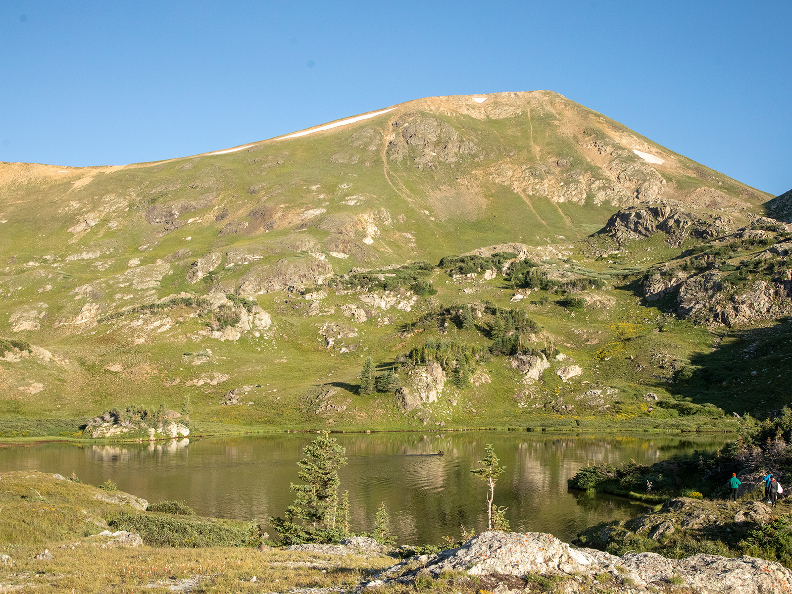
King Lake

- Trail length: 10.4 miles, round trip
- Distance from Denver: 50.2 miles
- Closest town: Eldora
- Trailhead: Hessie
There’s no getting around the reality that parking for the Hessie trailhead—which gives entrée to the Indian Peaks Wilderness, Lost Lake, Woodland Lake, Devil’s Thumb Lake, and King Lake, among other desirable spots—is a nightmare. Be smart and avoid the melee by simply parking at Nederland High School and grabbing the free shuttle. You’ll be glad you avoided all that parking stress once you begin climbing.
The trailhead starts from a rocky road that quickly gains elevation. You’ll pass some nice camping spots (accessible by high-clearance, four-wheel-drive vehicles) and then come to a span over the North Fork Middle Boulder Creek after about a half mile. Roughly a mile later, cross a bridge over raging South Fork Middle Boulder Creek and then ascend a wide trail, which eventually melts into singletrack with some ahhhh-inducing shade for about two miles. You’ll pass a split for Betty & Bob Lakes Trail around mile 3.6, but keep going to see gorgeous wildflowers—and ultimately King Lake.
Surrounded by the Indian Peaks, King Lake is tucked into a gently rounded cirque that, at more than 11,500 feet, promises to still have snow into July. Pick a grassy spot to enjoy the view and a snack before turning around. Or, if you’re jonesing for more mileage, try the High Lonesome Loop: Continue past the lake and climb above it, where the trail will meet up with the Continental Divide Trail at Rollins Pass. Travel along the divide for roughly 2.5 miles before dropping down steeply toward Devil’s Thumb Lake Trail (#902), which eventually meets back up with King Lake Trail. —SB
Comanche Lake

- Trail length: 8.2 miles, round trip (or 13.3 miles if you do full Venable-Comanche Loop)
- Distance from Denver: 158 miles
- Closest town: Westcliffe
- Trailhead: Venable-Comanche
Tucked just west of the town of Westcliffe, the Venable-Comanche Loop is a rugged, rarely crowded circuit with scenery that’s worth the 13.3-mile slog. Yes, you can go out and back to the lake on Comanche Trail (#746), which climbs steadily and steeply on a heavily forested path up to Comanche Lake. But our recommendation would be to tackle the full circle counterclockwise by starting on a short feeder trail to reach Venable Lake Trail (#347) at Alvarado Campground.
From there, climb in earnest, scanning for Venable Falls (about 2.4 miles in), lovely aspen groves and flowing Venable Creek, and the Venable Lakes (about 4.6 miles in). Stay on Venable Lake Trail until taking a left onto Phantom Terrace Trail (#359), which is a camouflaged ledge with a 1,000-foot drop that you can’t see until you’re on it. Summon your courage because once you’ve conquered the terrace, find flowing singletrack along Spring Mountain before reaching Comanche Pass at mile 6.8. (At this point you can climb about 500 feet to summit Comanche Peak, if you so choose.) If not, take Comanche Trail (#746) down to beautiful Comanche Lake, where you can get a line wet if you packed your rod. Take a breather here before enjoying the downhill hike on the remaining 4.1 miles back to your car. —SB
Parika Lake
- Trail length: 11.1 miles, round trip
- Distance from Denver: 103 miles
- Closest town: Grand Lake
- Trailhead: Bowen-Baker
Nestled in a basin surrounded by 12,000-foot peaks in the Never Summer Wilderness, this sublime alpine lake feels wonderfully remote, untouched by the outside world. Perhaps that’s because not many people are willing to work for it. At around 5.5 miles one way, the trail is a steady uphill grind, gaining more than 2,500 feet of elevation.
From the Bowen-Baker trailhead, start your trek on a wide gravel trail. Around 0.3 miles in, reach a gate; take the Baker Gulch Trail to the right, and enjoy an undemanding stroll among the trees for the next few miles. Around mile three, encounter a boulder field. As you’re scrambling, be sure to steal a few glances skyward at Peak 12,442, one of the mountains towering over Parika Lake. At 3.4 miles, cross a rudimentary log bridge over the Grand Ditch, an irrigation canal that diverts water to the Cache la Poudre River. Stay right to continue on the Baker Gulch Trail. Just before mile 4, you’ll cross a small stream—without a bridge this time, so your feet may get wet. As you approach the Parika Lake junction, continue straight. This is an excellent time to double-check your route (you brought a map, right?).
Settle in for an uphill grind, where the trail briefly flirts with a 24-percent grade. At the next junction, around mile 5.3, hang a left. From here, it’s a short jaunt to the lake’s crisp, blue waters. If you’re lucky, you may spot a moose going for a dip. Once you’re done basking in your well-earned reward, head back the way you came (and relish in the fact that your return trip will be virtually all downhill). —SB
Chihuahua Lake
Trail length: 7.8 miles, round trip
Distance from Denver: 77 miles
Closest town: Dillon
Trailhead: Intersection of Peru Creek Road and Chihuahua Gulch Road
For those who love to mix activities, the journey to Chihuahua Lake is a great option not too far from Denver. Those with a penchant for high-clearance, four-wheel-drive off-roading can crawl up Chihuahua Gulch Road, a seriously rock- and dip-strewn dirt road that anyone with a two-wheel-drive vehicle will have to consider part of the hike.
Whether you use big ole tires or your boot-clad feet to reach Chihuahua Lake Trail two miles in, this is where the skyward ascent begins. Although most of the trek is relatively low on the hardcore scale, there are several creek crossings (bring water shoes and extra socks) and a steep section right before you get to the lake. But the views of the high-alpine basin and of several 13,000- and 14,000-foot mountains—including Torreys and Grays peaks (which are summitable via Grays Peaks’ southwest ridge from a road that splinters off Chihuahua Gulch Road)—will make you forget all about your wet feet and all that huffing and puffing. The lake itself is a deep blue jewel, often ringed with snow well into the summer, that you won’t want to stop staring at all afternoon. —Lindsey B. King
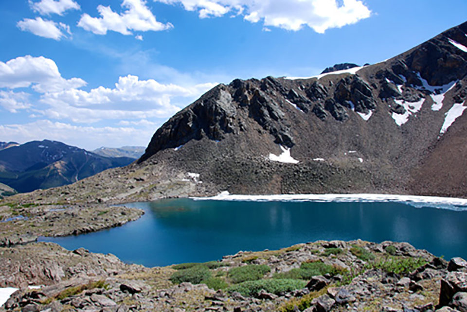
Crater Lakes
- Trail length: 5.2 miles, round trip (5.9 miles to the upper lake, round trip)
- Distance from Denver: 52 miles
- Closest town: Rollinsville
- Trailhead: East Portal
It seems like all the other “Crater Lakes” in Colorado get the glory. The one nestled in the Indian Peaks Wilderness is said to be the closest Coloradans can get to hiking in the Dolomites without hopping a flight. Meanwhile, the one in the Aspen area delivers you right to the base of the iconic Maroon Bells. Well, we’d like to make a case for the Crater Lake tucked away in the James Peak Wilderness. Actually a family of four pools, this Crater Lake is closer to Denver and demands less legwork.
The trail leaves from the popular East Portail trailhead at Moffat Tunnel. From here, set out on South Boulder Creek Trail, a blessedly shady path that was once an old mining road (pass a decrepit mining cabin to prove it). The route is easygoing for the first 2.2 miles, just be sure to keep straight when you reach the Forest Lakes junction. Weave through aspen groves and cross a few streams via primitive wooden bridges (good opportunities for four-legged friends to cool off). At 2.2 miles, hang a right to pick up the Crater Lakes Trail and prepare to earn the impending awe. The bad news: You’ll have to tackle the occasional 38-percent grade during the last mile. The good news: You’re in the shade the whole time.
Around 2.5 miles, emerge from the trees into a field (full of wildflowers in the summer), and the lower Crater Lakes will come into view on your left. Don’t stop here. The trail runs right up the middle of two of them, with numerous spots to settle down for a bagged lunch. For panoramic views of the Crater Lakes, climb another steep 0.7 miles to the more secluded Upper Crater Lake. If you don’t want to leave (we don’t blame you), pitch a tent at one of the many backcountry sites. —JG


